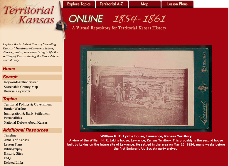
Territorial Kansas Online - Project retired
Territorial Kansas Online was a repository of digitized historical materials from the collections of the Kansas State Historical Society and the Kansas Collection of the University of Kansas representing the time period from 1854 through January 1861, when Kansas entered the Union. The project was made possible through a major grant from the Institute of Museum and Library Services. Project work included lessons plans developed to enhance the teaching of U. S. history at the middle school, high school, and college levels.
Though the original Territorial Kansas Online website was retired in January 2022, digital materials from the project remain available in the Kansas Memory digital collections at the Kansas State Historical Society and the the University of Kansas Libraries digital collections. The Internet Archive has captured an archive of the site.